COLLECTION NAME:
David Rumsey Historical Map Collection
Record
Author:
Melish, John
Date:
1815
Short Title:
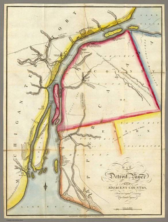
Map of Detroit River and Adjacent Country.
Publisher:
John Melish
Publisher Location:
Philadelphia
Type:
Atlas Map
Obj Height cm:
58
Obj Width cm:
43
Scale 1:
63,360
Note:
Fold-out map in outline color showing the Detroit River from Detroit to Lake Erie.
Reference:
P1347; Sabin 47432; Ristow p180.
Region:
Detroit River
Subject:
Rivers
Full Title:
Map of Detroit River and Adjacent Country, From an Original Drawing, by a British Engineer.
List No:
2788.007
Series No:
9
Engraver or Printer:
Tanner, Henry S.
Publication Author:
Melish, John
Pub Date:
1815
Pub Title:
A Military and Topographical Atlas of the United States; Including The British Possessions & Florida ... By John Melish. Philadelphia, Published By John Melish. G. Palmer Printer 1815. (on verso) District of Pennsylvania ... fourteenth day of March ... 1815 ... John Melish ... hath deposited ... a book.
Pub Reference:
P1347; Sabin 47432; Ristow p180.
Pub Note:
2nd edition. 9 large folding maps, 3 small maps. Melish adds four large maps, two of the St. Lawrence river area, one of the Creek Indian Territory, and one of New Orleans. Catalogue of Melish's works in front. Maps in outline color bound in half leather with fabric ties. "Military Atlas" imprinted on the spine.
Pub List No:
2788.000
Pub Type:
National Atlas
Pub Maps:
12
Pub Height cm:
22
Pub Width cm:
14
Image No:
2788007
Download 1:
Full Image Download in MrSID Format
Download 2:
MrSID Image Viewer for Windows
Authors:
Melish, John
Collection:
Rumsey Collection
Map of Detroit River and Adjacent Country.